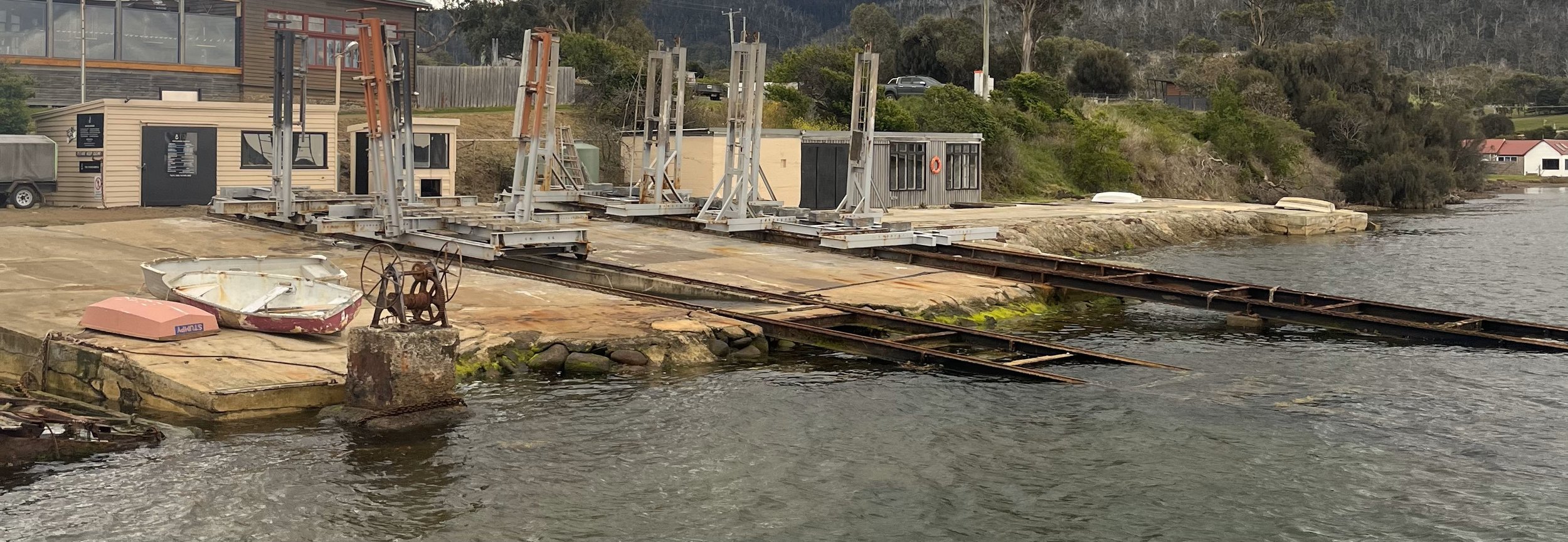
THE CANNERY SLIPWAY
DUNALLEY, TASMANIA
SLIPWAY
Located in Southern Tasmania, Dunalley is a small fishing town that can be accessed both from Marion Bay on Tasmania’s East Coast & the safety & convenience of the Denison Canal. This Canal has been used by fishing boats, sailing vessels and everything in-between since its opening in 1905.
Dunalley truly is steeped in Timber Vessel history & the Cannery Slipway is proud to continue this tradition
THE CANNERY SLIPWAY
The Cannery Slipway offers a pristine & convenient location for Vessels to slip & have all required works completed with qualified shipwrights on site & operating her 2x 50 Tonne Capacity Cradles.
The Cannery Slipway can accommodate Vessels of all kinds up to 60 foot & 5.5 Metre Beam.
Visit the Cannery slipway to receive first class service & competitive pricing for your next slipping & let Shippies Shipwright Services handle all of your slipping requirements!
Click the Link below to learn more about the Cannery Slipway
GETTING HERE:
DENSION CANAL:
From Hobart to southern tip of Maria Island, you can save approx. 24Nm by transiting via the Denison Canal (46Nm) as opposed to via Tasman Island (70Nm)
Transit via the Denison Canal available from 8am to 5pm (Bookings required for swing bridge opening at least one day in advance)
Flood Stream commences 2Hrs & 27Mins after low water at Hobart. Ebb Stream commences 2Hrs & 16mins after High water at Hobart (Slack water is at approx. 2hrs after Hobart high tide & approx. 2hrs & 10mins after Hobart Low tide)
Approach Channel & Denison Canal have minimum depths of approx. 1.4m to 1.7m at Chart Datum
Tidal Streams of 3 knots can be experienced within the Denison Canal & transit is recommended on slack water
When transiting in the Denison Canal ensure to transit via all channel marks prior to turning North toward Jetty & Slipway
Approx. 2Nm from beginning of Denison Canal to The Cannery Slipway (From Fredrick Henry Bay End).
USEFUL REASOURCES FOR NAVIGATION:
MARION BAY NARROWS:
Do not attempt to enter Blackmans Bay through the Marion Bay Narrows in heavy North-Easterly conditions.
Use Chart AUS169 to Navigate the Marion Bay Narrows
Recommend to navigate at High Tide & during daylight hours
Navigate Blackmans Bay via Marked channel & navigate with caution due to numerous shell fish farms
Tidal Streams: Main stream of flood tide runs into Blackmans Bay in a South-Westerly direction at the Marion Bay Narrows (The reverse applies for the Ebb Tide)
Recomend refering to Mast charlet & downloaded track which can be uploaded onto your chart plotter
Marion Bay Narrows to The Cannery Slipway approx 5NM
USEFUL REASOURCES FOR NAVIGATION:


